


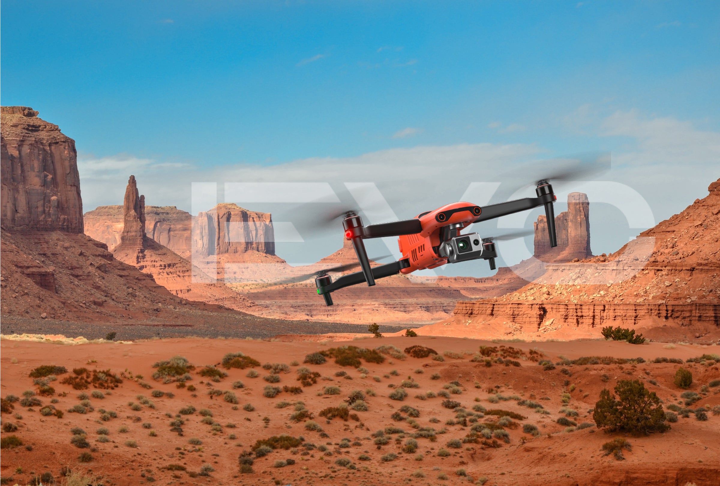
Autel EVO II Pro RTK V3 is an advanced drone model that offers an impressive range of features designed for surveying and mapping applications. This drone is equipped with advanced RTK technology that allows it to achieve highly accurate positioning with an accuracy of up to 1cm+1ppm (1.5cm+1ppm). This makes it ideal for use in a wide range of industries, including construction, agriculture, and mining.
Overall, the Autel EVO II Pro RTK V3 is an outstanding drone that delivers exceptional performance and versatility for surveying and mapping applications. Whether you are working in construction, agriculture, or any other industry that requires highly accurate data and detailed maps, the Autel EVO II Pro RTK V3 is the ideal solution for your needs.

 1 inch CMOS Sensor
 6K/30fps Videos
 Surverying Mapping
 Multi-NTRIP Profile Saving
 15km Transmission Range
 360° Obstacle Avoidance
 Dynamic Track 2.1
 38 Minutes Flight Time
 7.9 Smart Controller V3
 RTK Horizontal Positioning
 RTK Vertical Positioning
 The EVO II RTK V3 introduces a brand-new RTK module, which provides real-time centimeter-level positioning data, and supports Post-Processing
Kinematic (PPK).
The aircraft can record the original satellite observation data, camera exposure parameters and more. The positioning system supports an
RTK base station and NTRIP RTK network, which help to achieve accurate and stable data acquisition in complex operation environments.

EVO II RTK Series V3 can connect to an NTRIP network and does not need GCPs to provide centimeter-grade accuracy.

EVO II RTK Series V3 supports all NTRIP-compatible base stations.


For repeatable data acquisition missions, you can record the drone's previous shooting positions. All the gimbals, camera, and aircraft movements will be replicated, thus producing a full record of the entire mission.

For repeatable missions, you can record the drone's previous shooting parameters. The gimbal, camera, and movement settings will be replicated, allowing missions to be easily duplicated.

The Explorer App allows the user to create and save multiple NTRIP profiles for different locations, so they don't have to manually input a new flight plan for every new location.

EVO II Pro RTK V3 has high dynamic range and powerful low light performance, enabling users to capture clear detail sets with minimal distortion and noise.

The EVO II Pro RTK V3 comes with a NEW updated 1-inch 6K CMOS image sensor with a maximum of 20 megapixels. Thanks to the ultra-sensitive algorithm, you can still shoot clean, detailed, low-noise data sets under twilight or night conditions.
Adapt to lighting changes by adjusting the lens aperture size, giving the pilot more shutter speed control.
EVO II Pro RTK V3 has optimized its datasets to be easily adjusted with post processing software applications.


EVO II Pro RTK V3 has optimized its datasets to be easily adjusted with post processing software applications.
Equipped with 19 groups of sensors including 12 visual sensors,the main camera, ultrasound, IMUs and other sensors enable building of three-dimensional maps and path planning in real time.

*Please refer to the manual for details on obstacle avoidance and its limitations, which may or may not work in limited lighting environments, under direct strong sunlight, or across thin tree branches or wires.
Rectangular and Polygon mission planners - Those are going to be great for anybody that's dealing with photogrammetry. So anybody that needs to be able to capture a lot of images in a rectangular mission or polygon mission, you're going to be able to do that in an autonomous fashion. Then you're going to be able to take EVO II Pro RTK V3's images and upload them to your 3D mapping


SkyLink 2.0 is built into the EVO II RTK V3 chipset, expanding the possibilities for your most critical workflows.
Do more because you can fly further away.
Incredible video resolution within a mile, meeting most common use cases.
Supports tri-band communication with automatic frequency hopping for maximum anti-interference capabilities.
* 900MHz is only applicable for FCC countries.


The EVO II RTK Series V3 folds up for ease of transport and deployment.

The EVO II RTK Series V3 only takes 45 seconds from setup to takeoff.


EVO II's Smaller Cross Section and powerful motors allows greater stability and control in all windy conditions.

EVO II RTK Series V3 does not have any no fly zones and will not prevent the pilot from taking off.

Enjoy up to 38 minutes of flight time - 20%~30% more than the next leading competitor for more area coverage and longer missions.

EVO II RTK Series V3 does not need to be on the latest hardware or app version in order to take off unlike other competitors.
*Please fly safely and consult your local laws and regulations. Autel Robotics is not liable for any unauthorized flights.
**It’s required to update the latest firmware and app to enjoy comprehensive warranty. More information please refer to warranty policy.
EVO 2 Pro RTK V3 will return home automatically when Low Aircraft Battery Level and Communication Lost. Additionally, EVO 2 V3’s bottom binocular vision camera to create a density depth map. Then, it calculates the depth map's flatness and angles to ensure an accurate and safe landing.
Smart Controller V3's 7.9-inch, 2000 nit high-brightness screen is clearly visible even under direct sunlight. SkyLink 2.0 Transmission technology guarantees long-distance operations from up to 9 miles away and enhances anti-interference abilities with triple-band frequency hopping. The customized Android system allows for additional flexibility with 3rd party apps and an IP43 rating ensures all weather performance.

7.9-Inch HD Touch Screen

-4 °F to 104 °F Temperature Range

2000 nits Maximum Brightness

IP43 Resistance

EVO II Pro RTK V3 supports multi-port HDMI real-time output to meet the requirements of projection monitoring and live streaming with Live Deck 2.

1080P/60FPS Video Stream

Three Auto-Switch Bands

Transmission Range

5-Hour Battery Life

IP43 Resistance

| Sensor | 1" CMOS Effective Pixels: 20 MP |
| Lens | FOV: 82° Equivalent focal length: 29 mm Aperture: f/2.8 - f/11 Focus range: 0.5 m to infinity |
| ISO Range | Video: 100-44000 Photo: 100-6400 |
| Shutter Speed | Photo mode: 1/8000 ~ 8s Other: 1/8000 ~ 1/frame rates |
| Zoom | 1 ~ 16x (Max. 3x lossless zoom) |
| Photo mode | Single shot/Burst shooting/AEB/Time Lapse/HDR |
| Maximum photo size | 5472*3648 (3:2) 5472*3076 (16:9) 3840*2160 (16:9) |
| Image Format | JPG (default) / 12bits DNG / JPG+12bits DNG |
| Photo mode | 5472x3076P30/P25/P24 3840x2160P60/P50/P48/P30/P25/P24 2720x1528P60/P50/P48/P30/P25/P24 1920x1080P60/P50/P48/P30/P25/P24 |
| Video format | MP4 / MOV (MPEG-4 AVC/H.264, HEVC/H.265) |
| Max bitrate | 80Mbps |
| Supported file system | FAT32/exFAT |
| Gimbal | 3-axis stabilization |
| Mechanical range | Tilt: -135° to +45°; Pan: -100° to +100° |
| Controllable rotation range | Tilt: -90° to +30°; Pan: -90° to +90° |
| Max control speed (Tilt) | 300°/s |
| Angular Vibration Range | ±0.005° |
| Takeoff Weight | 1237g±0.5g(EVO II Pro RTK V3) |
| Max takeoff weight | 4.41 lbs (1999 g) |
| Size(L*W*H) | 9.1*5.1*5.6 inches; 230*130*143mm(folded); 18*22*4.3 inches 457*558*143 mm(unfolded) |
| Wheelbase | 15.63 inches (397 mm) |
| Maximum Takeoff Altitude | 7000 m |
| Max ascent speed | 8 m/s (Ludicrous) |
| Max descent speed | 4 m/s (Ludicrous) |
| Max horizontal flight speed | 20m/s (Ludicrous) |
| Max flight distance (no wind) | 21 km |
| Max tilt angle | 33° (Ludicrous) |
| Max angular velocity | 120°/s |
| Max flight time (no wind) | 36 min |
| Max hovering time (no wind) | 32 min |
| Operating temperature range | 14°F to 104°F (-10℃ ~ 40℃) |
| Maximum resistance to wind | 27mph, 12 m/s (Take-off and landing) |
| Operating frequency | 902-928MHz (FCC Only) 2.400-2.4835GHz 5.725-5.850GHz |
| Transmission power | 900M FCC/ ISED:≤31dBm 2.4G FCC/ ISED:≤32dBm SRRC/CE/MIC/RCM:≤20dBm 5.8G (non-Japan) ; 5.7G (Japan) FCC/ISED/SRRC/MIC:≤33dBm CE/ RCM:≤14dBm |
| Hovering accuracy | When RTK is enabled and working normally: Vertical: ±0.1 m; Horizontal: ±0.1 m Vertical: ±0.1 m (when the visual positioning is working normally);±0.5 m (when GNSS works normally) Horizontal: ±0.3 m (when the visual positioning is working normally); ±1.5 m (when GNSS works normally) |
| Image position compensation | The position of the camera center relative to the phase center of the airborne A-RTK antenna, under the body axis system: (-2.63, 0.31, 83.5) mm, and the photo EXIF coordinates have been compensated. The positive XYZ axis of the body axis system points to the front, right, and bottom of the aircraft respectively. |
| Internal storage | 8GB |
| SD storage | max. support 256GB (UHS-3 or Class 10) |
| Single frequency high sensitivity GNSS | GPS+BeiDou+Galileo(Asia) GPS+GLONASS+Galileo(Other areas) |
| Multi-frequency multi-system high-precision RTK GNSS | Frequency points used: GPS:L1/L2; GLONASS:L1/L2; BeiDou:B1/B2; Galileo:E1/E5 First positioning time:<50 s Positioning accuracy: vertical 1.5 cm + 1 ppm (RMS); Horizontal 1 cm + 1 ppm (RMS) 1 ppm means that the error increases by 1 mm for every 1 km the aircraft moves |
| Sensing System | Omnidirectional Obstacle Sensing |
| Forward | Precision Measurement Range: 0.5-18 m Effective Sensing Speed: <12m/s FOV: Horizontal: 60°, Vertical: 80° |
| Backward | Precision Measurement Range: 0.5-16 m Effective Sensing Speed: <12m/s FOV: Horizontal: 60°, Vertical: 80° |
| Upward | Precision Measurement Range: 0.5-10 m Effective Sensing Speed: <5m/s FOV: Horizontal: 65°, Vertical: 50° |
| Downward | Precision Measurement Range: 0.5-10 m Effective Sensing Speed: <5m/s FOV: Horizontal: 100°, Vertical: 80° |
| Sides | Precision Measurement Range: 0.5-10 m Effective Sensing Speed: <5m/s FOV: Horizontal: 65°, Vertical: 50° |
| Operating Environment |
|
| Operating Frequency | 902-928MHz (FCC Only) 2.400-2.4835GHz 5.725-5.850GHz (non-Japan) 5.650-5.755GHz (Japan Only) |
| Transmission power(E.I.R.P) | FCC:≤33dBm CE:≤20dBm@2.4G,≤14dBm@5.8G SRRC:≤20dBm@2.4G ≤33dBm@5.8G/5.7G |
| Max Transmission Distance (unobstructed, free of interference) | FCC:15km CE:8km |
| Display screen | 2048x1536 60fps |
| Battery | 5800mAh |
| Operating time | ~3 hours (Max. Brightness) ~4.5 hours (50% Brightness) |
| Charging time | 120 minutes |
| Internal Storage | ROM 128GB |
| Capacity | 7100 mAh |
| Voltage | 11.55 V |
| Max Charging Voltage | 13.2 V |
| Battery Type | LiPo 3S |
| Energy | 82 Wh |
| Net Weight | 0.81 lbs (365 grams) |
| Charging Temperature Range | 41°F to 104°F (5°C to 40°C) |
| Storage Temperature and Humidity | -10~30℃,65±20%RH |
| Recommended Storage Temperature | 22-28℃ |
| Max Charging Power | 93W |
| Charging Time | 90 minutes |
| Input | 100-240 V, 50/60 Hz, 1.5A |
| Output | 13.2 V ⎓ 5 A 5V⎓3A 9V⎓2A 12V⎓1.5A |
| Voltage | 13.2±0.1V |
| Rated power | 66W |
| Voltage | 13.2 V |
| Charging temperature range | 5℃ to 45℃ |

|
Name |
Download |
|
EVO II RTK V3 Brochure - EN.pdf |
Download_File |
|
Specs For EVO II RTK Series V3 - .pdf |
Download_File |
|
Autel Smart Controller V3 Brochure |
Download_File |
|
Specs For Autel Smart Controller V3 |
Download_File |
|
Autel Live Deck 2 Brochure |
Download_File |
|
Specs For Autel Live Deck 2 |
Download_File |
| Sensor | 1" CMOS Effective Pixels: 20 MP |
| Lens | FOV: 82° Equivalent focal length: 29 mm Aperture: f/2.8 - f/11 Focus range: 0.5 m to infinity |
| ISO Range | Video: 100-44000 Photo: 100-6400 |
| Shutter Speed | Photo mode: 1/8000 ~ 8s Other: 1/8000 ~ 1/frame rates |
| Zoom | 1 ~ 16x (Max. 3x lossless zoom) |
| Photo mode | Single shot/Burst shooting/AEB/Time Lapse/HDR |
| Maximum photo size | 5472*3648 (3:2) 5472*3076 (16:9) 3840*2160 (16:9) |
| Image Format | JPG (default) / 12bits DNG / JPG+12bits DNG |
| Photo mode | 5472x3076P30/P25/P24 3840x2160P60/P50/P48/P30/P25/P24 2720x1528P60/P50/P48/P30/P25/P24 1920x1080P60/P50/P48/P30/P25/P24 |
| Video format | MP4 / MOV (MPEG-4 AVC/H.264, HEVC/H.265) |
| Max bitrate | 80Mbps |
| Supported file system | FAT32/exFAT |
| Gimbal | 3-axis stabilization |
| Mechanical range | Tilt: -135° to +45°; Pan: -100° to +100° |
| Controllable rotation range | Tilt: -90° to +30°; Pan: -90° to +90° |
| Max control speed (Tilt) | 300°/s |
| Angular Vibration Range | ±0.005° |
| Takeoff Weight | 1237g±0.5g(EVO II Pro RTK V3) |
| Max takeoff weight | 4.41 lbs (1999 g) |
| Size(L*W*H) | 9.1*5.1*5.6 inches; 230*130*143mm(folded); 18*22*4.3 inches 457*558*143 mm(unfolded) |
| Wheelbase | 15.63 inches (397 mm) |
| Maximum Takeoff Altitude | 7000 m |
| Max ascent speed | 8 m/s (Ludicrous) |
| Max descent speed | 4 m/s (Ludicrous) |
| Max horizontal flight speed | 20m/s (Ludicrous) |
| Max flight distance (no wind) | 21 km |
| Max tilt angle | 33° (Ludicrous) |
| Max angular velocity | 120°/s |
| Max flight time (no wind) | 36 min |
| Max hovering time (no wind) | 32 min |
| Operating temperature range | 14°F to 104°F (-10℃ ~ 40℃) |
| Maximum resistance to wind | 27mph, 12 m/s (Take-off and landing) |
| Operating frequency | 902-928MHz (FCC Only) 2.400-2.4835GHz 5.725-5.850GHz |
| Transmission power | 900M FCC/ ISED:≤31dBm 2.4G FCC/ ISED:≤32dBm SRRC/CE/MIC/RCM:≤20dBm 5.8G (non-Japan) ; 5.7G (Japan) FCC/ISED/SRRC/MIC:≤33dBm CE/ RCM:≤14dBm |
| Hovering accuracy | When RTK is enabled and working normally: Vertical: ±0.1 m; Horizontal: ±0.1 m Vertical: ±0.1 m (when the visual positioning is working normally);±0.5 m (when GNSS works normally) Horizontal: ±0.3 m (when the visual positioning is working normally); ±1.5 m (when GNSS works normally) |
| Image position compensation | The position of the camera center relative to the phase center of the airborne A-RTK antenna, under the body axis system: (-2.63, 0.31, 83.5) mm, and the photo EXIF coordinates have been compensated. The positive XYZ axis of the body axis system points to the front, right, and bottom of the aircraft respectively. |
| Internal storage | 8GB |
| SD storage | max. support 256GB (UHS-3 or Class 10) |
| Single frequency high sensitivity GNSS | GPS+BeiDou+Galileo(Asia) GPS+GLONASS+Galileo(Other areas) |
| Multi-frequency multi-system high-precision RTK GNSS | Frequency points used: GPS:L1/L2; GLONASS:L1/L2; BeiDou:B1/B2; Galileo:E1/E5 First positioning time:<50 s Positioning accuracy: vertical 1.5 cm + 1 ppm (RMS); Horizontal 1 cm + 1 ppm (RMS) 1 ppm means that the error increases by 1 mm for every 1 km the aircraft moves |
| Sensing System | Omnidirectional Obstacle Sensing |
| Forward | Precision Measurement Range: 0.5-18 m Effective Sensing Speed: <12m/s FOV: Horizontal: 60°, Vertical: 80° |
| Backward | Precision Measurement Range: 0.5-16 m Effective Sensing Speed: <12m/s FOV: Horizontal: 60°, Vertical: 80° |
| Upward | Precision Measurement Range: 0.5-10 m Effective Sensing Speed: <5m/s FOV: Horizontal: 65°, Vertical: 50° |
| Downward | Precision Measurement Range: 0.5-10 m Effective Sensing Speed: <5m/s FOV: Horizontal: 100°, Vertical: 80° |
| Sides | Precision Measurement Range: 0.5-10 m Effective Sensing Speed: <5m/s FOV: Horizontal: 65°, Vertical: 50° |
| Operating Environment |
|
| Operating Frequency | 902-928MHz (FCC Only) 2.400-2.4835GHz 5.725-5.850GHz (non-Japan) 5.650-5.755GHz (Japan Only) |
| Transmission power(E.I.R.P) | FCC:≤33dBm CE:≤20dBm@2.4G,≤14dBm@5.8G SRRC:≤20dBm@2.4G ≤33dBm@5.8G/5.7G |
| Max Transmission Distance (unobstructed, free of interference) | FCC:15km CE:8km |
| Display screen | 2048x1536 60fps |
| Battery | 5800mAh |
| Operating time | ~3 hours (Max. Brightness) ~4.5 hours (50% Brightness) |
| Charging time | 120 minutes |
| Internal Storage | ROM 128GB |
| Capacity | 7100 mAh |
| Voltage | 11.55 V |
| Max Charging Voltage | 13.2 V |
| Battery Type | LiPo 3S |
| Energy | 82 Wh |
| Net Weight | 0.81 lbs (365 grams) |
| Charging Temperature Range | 41°F to 104°F (5°C to 40°C) |
| Storage Temperature and Humidity | -10~30℃,65±20%RH |
| Recommended Storage Temperature | 22-28℃ |
| Max Charging Power | 93W |
| Charging Time | 90 minutes |
| Input | 100-240 V, 50/60 Hz, 1.5A |
| Output | 13.2 V ⎓ 5 A 5V⎓3A 9V⎓2A 12V⎓1.5A |
| Voltage | 13.2±0.1V |
| Rated power | 66W |
| Voltage | 13.2 V |
| Charging temperature range | 5℃ to 45℃ |
|
Name |
Download |
|
EVO II RTK V3 Brochure - EN.pdf |
Download_File |
|
Specs For EVO II RTK Series V3 - .pdf |
Download_File |
|
Autel Smart Controller V3 Brochure |
Download_File |
|
Specs For Autel Smart Controller V3 |
Download_File |
|
Autel Live Deck 2 Brochure |
Download_File |
|
Specs For Autel Live Deck 2 |
Download_File |
OVERVIEW
Autel EVO II Pro RTK V3 is an advanced drone model that offers an impressive range of features designed for surveying and mapping applications. This drone is equipped with advanced RTK technology that allows it to achieve highly accurate positioning with an accuracy of up to 1cm+1ppm (1.5cm+1ppm). This makes it ideal for use in a wide range of industries, including construction, agriculture, and mining.
Overall, the Autel EVO II Pro RTK V3 is an outstanding drone that delivers exceptional performance and versatility for surveying and mapping applications. Whether you are working in construction, agriculture, or any other industry that requires highly accurate data and detailed maps, the Autel EVO II Pro RTK V3 is the ideal solution for your needs.
1 inch CMOS Sensor 6K/30fps Videos Surverying Mapping Multi-NTRIP Profile Saving 15km Transmission Range 360° Obstacle Avoidance Dynamic Track 2.1 38 Minutes Flight Time 7.9 Smart Controller V3 RTK Horizontal Positioning RTK Vertical Positioning The EVO II RTK V3 introduces a brand-new RTK module, which provides real-time centimeter-level positioning data, and supports Post-Processing
Kinematic (PPK).
The aircraft can record the original satellite observation data, camera exposure parameters and more. The positioning system supports an
RTK base station and NTRIP RTK network, which help to achieve accurate and stable data acquisition in complex operation environments.
EVO II RTK Series V3 can connect to an NTRIP network and does not need GCPs to provide centimeter-grade accuracy.
EVO II RTK Series V3 supports all NTRIP-compatible base stations.
For repeatable data acquisition missions, you can record the drone's previous shooting positions. All the gimbals, camera, and aircraft movements will be replicated, thus producing a full record of the entire mission.
For repeatable missions, you can record the drone's previous shooting parameters. The gimbal, camera, and movement settings will be replicated, allowing missions to be easily duplicated.
The Explorer App allows the user to create and save multiple NTRIP profiles for different locations, so they don't have to manually input a new flight plan for every new location.
EVO II Pro RTK V3 has high dynamic range and powerful low light performance, enabling users to capture clear detail sets with minimal distortion and noise.
The EVO II Pro RTK V3 comes with a NEW updated 1-inch 6K CMOS image sensor with a maximum of 20 megapixels. Thanks to the ultra-sensitive algorithm, you can still shoot clean, detailed, low-noise data sets under twilight or night conditions.
Adapt to lighting changes by adjusting the lens aperture size, giving the pilot more shutter speed control.
EVO II Pro RTK V3 has optimized its datasets to be easily adjusted with post processing software applications.
EVO II Pro RTK V3 has optimized its datasets to be easily adjusted with post processing software applications.
Equipped with 19 groups of sensors including 12 visual sensors,the main camera, ultrasound, IMUs and other sensors enable building of three-dimensional maps and path planning in real time.
*Please refer to the manual for details on obstacle avoidance and its limitations, which may or may not work in limited lighting environments, under direct strong sunlight, or across thin tree branches or wires.
Rectangular and Polygon mission planners - Those are going to be great for anybody that's dealing with photogrammetry. So anybody that needs to be able to capture a lot of images in a rectangular mission or polygon mission, you're going to be able to do that in an autonomous fashion. Then you're going to be able to take EVO II Pro RTK V3's images and upload them to your 3D mapping
SkyLink 2.0 is built into the EVO II RTK V3 chipset, expanding the possibilities for your most critical workflows.
Do more because you can fly further away.
Incredible video resolution within a mile, meeting most common use cases.
Supports tri-band communication with automatic frequency hopping for maximum anti-interference capabilities.
* 900MHz is only applicable for FCC countries.
The EVO II RTK Series V3 folds up for ease of transport and deployment.
The EVO II RTK Series V3 only takes 45 seconds from setup to takeoff.
EVO II's Smaller Cross Section and powerful motors allows greater stability and control in all windy conditions.
EVO II RTK Series V3 does not have any no fly zones and will not prevent the pilot from taking off.
Enjoy up to 38 minutes of flight time - 20%~30% more than the next leading competitor for more area coverage and longer missions.
EVO II RTK Series V3 does not need to be on the latest hardware or app version in order to take off unlike other competitors.
*Please fly safely and consult your local laws and regulations. Autel Robotics is not liable for any unauthorized flights.
**It’s required to update the latest firmware and app to enjoy comprehensive warranty. More information please refer to warranty policy.
EVO 2 Pro RTK V3 will return home automatically when Low Aircraft Battery Level and Communication Lost. Additionally, EVO 2 V3’s bottom binocular vision camera to create a density depth map. Then, it calculates the depth map's flatness and angles to ensure an accurate and safe landing.
Smart Controller V3's 7.9-inch, 2000 nit high-brightness screen is clearly visible even under direct sunlight. SkyLink 2.0 Transmission technology guarantees long-distance operations from up to 9 miles away and enhances anti-interference abilities with triple-band frequency hopping. The customized Android system allows for additional flexibility with 3rd party apps and an IP43 rating ensures all weather performance.
7.9-Inch HD Touch Screen
-4 °F to 104 °F Temperature Range
2000 nits Maximum Brightness
IP43 Resistance
EVO II Pro RTK V3 supports multi-port HDMI real-time output to meet the requirements of projection monitoring and live streaming with Live Deck 2.
1080P/60FPS Video Stream
Three Auto-Switch Bands
Transmission Range
5-Hour Battery Life
IP43 Resistance
| Sensor | 1" CMOS Effective Pixels: 20 MP |
| Lens | FOV: 82° Equivalent focal length: 29 mm Aperture: f/2.8 - f/11 Focus range: 0.5 m to infinity |
| ISO Range | Video: 100-44000 Photo: 100-6400 |
| Shutter Speed | Photo mode: 1/8000 ~ 8s Other: 1/8000 ~ 1/frame rates |
| Zoom | 1 ~ 16x (Max. 3x lossless zoom) |
| Photo mode | Single shot/Burst shooting/AEB/Time Lapse/HDR |
| Maximum photo size | 5472*3648 (3:2) 5472*3076 (16:9) 3840*2160 (16:9) |
| Image Format | JPG (default) / 12bits DNG / JPG+12bits DNG |
| Photo mode | 5472x3076P30/P25/P24 3840x2160P60/P50/P48/P30/P25/P24 2720x1528P60/P50/P48/P30/P25/P24 1920x1080P60/P50/P48/P30/P25/P24 |
| Video format | MP4 / MOV (MPEG-4 AVC/H.264, HEVC/H.265) |
| Max bitrate | 80Mbps |
| Supported file system | FAT32/exFAT |
| Gimbal | 3-axis stabilization |
| Mechanical range | Tilt: -135° to +45°; Pan: -100° to +100° |
| Controllable rotation range | Tilt: -90° to +30°; Pan: -90° to +90° |
| Max control speed (Tilt) | 300°/s |
| Angular Vibration Range | ±0.005° |
| Takeoff Weight | 1237g±0.5g(EVO II Pro RTK V3) |
| Max takeoff weight | 4.41 lbs (1999 g) |
| Size(L*W*H) | 9.1*5.1*5.6 inches; 230*130*143mm(folded); 18*22*4.3 inches 457*558*143 mm(unfolded) |
| Wheelbase | 15.63 inches (397 mm) |
| Maximum Takeoff Altitude | 7000 m |
| Max ascent speed | 8 m/s (Ludicrous) |
| Max descent speed | 4 m/s (Ludicrous) |
| Max horizontal flight speed | 20m/s (Ludicrous) |
| Max flight distance (no wind) | 21 km |
| Max tilt angle | 33° (Ludicrous) |
| Max angular velocity | 120°/s |
| Max flight time (no wind) | 36 min |
| Max hovering time (no wind) | 32 min |
| Operating temperature range | 14°F to 104°F (-10℃ ~ 40℃) |
| Maximum resistance to wind | 27mph, 12 m/s (Take-off and landing) |
| Operating frequency | 902-928MHz (FCC Only) 2.400-2.4835GHz 5.725-5.850GHz |
| Transmission power | 900M FCC/ ISED:≤31dBm 2.4G FCC/ ISED:≤32dBm SRRC/CE/MIC/RCM:≤20dBm 5.8G (non-Japan) ; 5.7G (Japan) FCC/ISED/SRRC/MIC:≤33dBm CE/ RCM:≤14dBm |
| Hovering accuracy | When RTK is enabled and working normally: Vertical: ±0.1 m; Horizontal: ±0.1 m Vertical: ±0.1 m (when the visual positioning is working normally);±0.5 m (when GNSS works normally) Horizontal: ±0.3 m (when the visual positioning is working normally); ±1.5 m (when GNSS works normally) |
| Image position compensation | The position of the camera center relative to the phase center of the airborne A-RTK antenna, under the body axis system: (-2.63, 0.31, 83.5) mm, and the photo EXIF coordinates have been compensated. The positive XYZ axis of the body axis system points to the front, right, and bottom of the aircraft respectively. |
| Internal storage | 8GB |
| SD storage | max. support 256GB (UHS-3 or Class 10) |
| Single frequency high sensitivity GNSS | GPS+BeiDou+Galileo(Asia) GPS+GLONASS+Galileo(Other areas) |
| Multi-frequency multi-system high-precision RTK GNSS | Frequency points used: GPS:L1/L2; GLONASS:L1/L2; BeiDou:B1/B2; Galileo:E1/E5 First positioning time:<50 s Positioning accuracy: vertical 1.5 cm + 1 ppm (RMS); Horizontal 1 cm + 1 ppm (RMS) 1 ppm means that the error increases by 1 mm for every 1 km the aircraft moves |
| Sensing System | Omnidirectional Obstacle Sensing |
| Forward | Precision Measurement Range: 0.5-18 m Effective Sensing Speed: <12m/s FOV: Horizontal: 60°, Vertical: 80° |
| Backward | Precision Measurement Range: 0.5-16 m Effective Sensing Speed: <12m/s FOV: Horizontal: 60°, Vertical: 80° |
| Upward | Precision Measurement Range: 0.5-10 m Effective Sensing Speed: <5m/s FOV: Horizontal: 65°, Vertical: 50° |
| Downward | Precision Measurement Range: 0.5-10 m Effective Sensing Speed: <5m/s FOV: Horizontal: 100°, Vertical: 80° |
| Sides | Precision Measurement Range: 0.5-10 m Effective Sensing Speed: <5m/s FOV: Horizontal: 65°, Vertical: 50° |
| Operating Environment |
|
| Operating Frequency | 902-928MHz (FCC Only) 2.400-2.4835GHz 5.725-5.850GHz (non-Japan) 5.650-5.755GHz (Japan Only) |
| Transmission power(E.I.R.P) | FCC:≤33dBm CE:≤20dBm@2.4G,≤14dBm@5.8G SRRC:≤20dBm@2.4G ≤33dBm@5.8G/5.7G |
| Max Transmission Distance (unobstructed, free of interference) | FCC:15km CE:8km |
| Display screen | 2048x1536 60fps |
| Battery | 5800mAh |
| Operating time | ~3 hours (Max. Brightness) ~4.5 hours (50% Brightness) |
| Charging time | 120 minutes |
| Internal Storage | ROM 128GB |
| Capacity | 7100 mAh |
| Voltage | 11.55 V |
| Max Charging Voltage | 13.2 V |
| Battery Type | LiPo 3S |
| Energy | 82 Wh |
| Net Weight | 0.81 lbs (365 grams) |
| Charging Temperature Range | 41°F to 104°F (5°C to 40°C) |
| Storage Temperature and Humidity | -10~30℃,65±20%RH |
| Recommended Storage Temperature | 22-28℃ |
| Max Charging Power | 93W |
| Charging Time | 90 minutes |
| Input | 100-240 V, 50/60 Hz, 1.5A |
| Output | 13.2 V ⎓ 5 A 5V⎓3A 9V⎓2A 12V⎓1.5A |
| Voltage | 13.2±0.1V |
| Rated power | 66W |
| Voltage | 13.2 V |
| Charging temperature range | 5℃ to 45℃ |
|
Name |
Download |
|
EVO II RTK V3 Brochure - EN.pdf |
Download_File |
|
Specs For EVO II RTK Series V3 - .pdf |
Download_File |
|
Autel Smart Controller V3 Brochure |
Download_File |
|
Specs For Autel Smart Controller V3 |
Download_File |
|
Autel Live Deck 2 Brochure |
Download_File |
|
Specs For Autel Live Deck 2 |
Download_File |
SPECS
| Sensor | 1" CMOS Effective Pixels: 20 MP |
| Lens | FOV: 82° Equivalent focal length: 29 mm Aperture: f/2.8 - f/11 Focus range: 0.5 m to infinity |
| ISO Range | Video: 100-44000 Photo: 100-6400 |
| Shutter Speed | Photo mode: 1/8000 ~ 8s Other: 1/8000 ~ 1/frame rates |
| Zoom | 1 ~ 16x (Max. 3x lossless zoom) |
| Photo mode | Single shot/Burst shooting/AEB/Time Lapse/HDR |
| Maximum photo size | 5472*3648 (3:2) 5472*3076 (16:9) 3840*2160 (16:9) |
| Image Format | JPG (default) / 12bits DNG / JPG+12bits DNG |
| Photo mode | 5472x3076P30/P25/P24 3840x2160P60/P50/P48/P30/P25/P24 2720x1528P60/P50/P48/P30/P25/P24 1920x1080P60/P50/P48/P30/P25/P24 |
| Video format | MP4 / MOV (MPEG-4 AVC/H.264, HEVC/H.265) |
| Max bitrate | 80Mbps |
| Supported file system | FAT32/exFAT |
| Gimbal | 3-axis stabilization |
| Mechanical range | Tilt: -135° to +45°; Pan: -100° to +100° |
| Controllable rotation range | Tilt: -90° to +30°; Pan: -90° to +90° |
| Max control speed (Tilt) | 300°/s |
| Angular Vibration Range | ±0.005° |
| Takeoff Weight | 1237g±0.5g(EVO II Pro RTK V3) |
| Max takeoff weight | 4.41 lbs (1999 g) |
| Size(L*W*H) | 9.1*5.1*5.6 inches; 230*130*143mm(folded); 18*22*4.3 inches 457*558*143 mm(unfolded) |
| Wheelbase | 15.63 inches (397 mm) |
| Maximum Takeoff Altitude | 7000 m |
| Max ascent speed | 8 m/s (Ludicrous) |
| Max descent speed | 4 m/s (Ludicrous) |
| Max horizontal flight speed | 20m/s (Ludicrous) |
| Max flight distance (no wind) | 21 km |
| Max tilt angle | 33° (Ludicrous) |
| Max angular velocity | 120°/s |
| Max flight time (no wind) | 36 min |
| Max hovering time (no wind) | 32 min |
| Operating temperature range | 14°F to 104°F (-10℃ ~ 40℃) |
| Maximum resistance to wind | 27mph, 12 m/s (Take-off and landing) |
| Operating frequency | 902-928MHz (FCC Only) 2.400-2.4835GHz 5.725-5.850GHz |
| Transmission power | 900M FCC/ ISED:≤31dBm 2.4G FCC/ ISED:≤32dBm SRRC/CE/MIC/RCM:≤20dBm 5.8G (non-Japan) ; 5.7G (Japan) FCC/ISED/SRRC/MIC:≤33dBm CE/ RCM:≤14dBm |
| Hovering accuracy | When RTK is enabled and working normally: Vertical: ±0.1 m; Horizontal: ±0.1 m Vertical: ±0.1 m (when the visual positioning is working normally);±0.5 m (when GNSS works normally) Horizontal: ±0.3 m (when the visual positioning is working normally); ±1.5 m (when GNSS works normally) |
| Image position compensation | The position of the camera center relative to the phase center of the airborne A-RTK antenna, under the body axis system: (-2.63, 0.31, 83.5) mm, and the photo EXIF coordinates have been compensated. The positive XYZ axis of the body axis system points to the front, right, and bottom of the aircraft respectively. |
| Internal storage | 8GB |
| SD storage | max. support 256GB (UHS-3 or Class 10) |
| Single frequency high sensitivity GNSS | GPS+BeiDou+Galileo(Asia) GPS+GLONASS+Galileo(Other areas) |
| Multi-frequency multi-system high-precision RTK GNSS | Frequency points used: GPS:L1/L2; GLONASS:L1/L2; BeiDou:B1/B2; Galileo:E1/E5 First positioning time:<50 s Positioning accuracy: vertical 1.5 cm + 1 ppm (RMS); Horizontal 1 cm + 1 ppm (RMS) 1 ppm means that the error increases by 1 mm for every 1 km the aircraft moves |
| Sensing System | Omnidirectional Obstacle Sensing |
| Forward | Precision Measurement Range: 0.5-18 m Effective Sensing Speed: <12m/s FOV: Horizontal: 60°, Vertical: 80° |
| Backward | Precision Measurement Range: 0.5-16 m Effective Sensing Speed: <12m/s FOV: Horizontal: 60°, Vertical: 80° |
| Upward | Precision Measurement Range: 0.5-10 m Effective Sensing Speed: <5m/s FOV: Horizontal: 65°, Vertical: 50° |
| Downward | Precision Measurement Range: 0.5-10 m Effective Sensing Speed: <5m/s FOV: Horizontal: 100°, Vertical: 80° |
| Sides | Precision Measurement Range: 0.5-10 m Effective Sensing Speed: <5m/s FOV: Horizontal: 65°, Vertical: 50° |
| Operating Environment |
|
| Operating Frequency | 902-928MHz (FCC Only) 2.400-2.4835GHz 5.725-5.850GHz (non-Japan) 5.650-5.755GHz (Japan Only) |
| Transmission power(E.I.R.P) | FCC:≤33dBm CE:≤20dBm@2.4G,≤14dBm@5.8G SRRC:≤20dBm@2.4G ≤33dBm@5.8G/5.7G |
| Max Transmission Distance (unobstructed, free of interference) | FCC:15km CE:8km |
| Display screen | 2048x1536 60fps |
| Battery | 5800mAh |
| Operating time | ~3 hours (Max. Brightness) ~4.5 hours (50% Brightness) |
| Charging time | 120 minutes |
| Internal Storage | ROM 128GB |
| Capacity | 7100 mAh |
| Voltage | 11.55 V |
| Max Charging Voltage | 13.2 V |
| Battery Type | LiPo 3S |
| Energy | 82 Wh |
| Net Weight | 0.81 lbs (365 grams) |
| Charging Temperature Range | 41°F to 104°F (5°C to 40°C) |
| Storage Temperature and Humidity | -10~30℃,65±20%RH |
| Recommended Storage Temperature | 22-28℃ |
| Max Charging Power | 93W |
| Charging Time | 90 minutes |
| Input | 100-240 V, 50/60 Hz, 1.5A |
| Output | 13.2 V ⎓ 5 A 5V⎓3A 9V⎓2A 12V⎓1.5A |
| Voltage | 13.2±0.1V |
| Rated power | 66W |
| Voltage | 13.2 V |
| Charging temperature range | 5℃ to 45℃ |
IN THE BOX
DOWNLOAD
|
Name |
Download |
|
EVO II RTK V3 Brochure - EN.pdf |
Download_File |
|
Specs For EVO II RTK Series V3 - .pdf |
Download_File |
|
Autel Smart Controller V3 Brochure |
Download_File |
|
Specs For Autel Smart Controller V3 |
Download_File |
|
Autel Live Deck 2 Brochure |
Download_File |
|
Specs For Autel Live Deck 2 |
Download_File |
Autel Robotics
Pair large text with a full-width image to draw attention to an important detail of your brand or product line.

The latest in Advanced Technology with a Foldable and Weather-resistant Design, the EVO Max 4T is as Portable as it can be
The Autel EVO II Dual 640T infrared drone is an innovative and advanced aerial solution with sharp video capture capabilities

Ada yang bisa kami bantu?
